
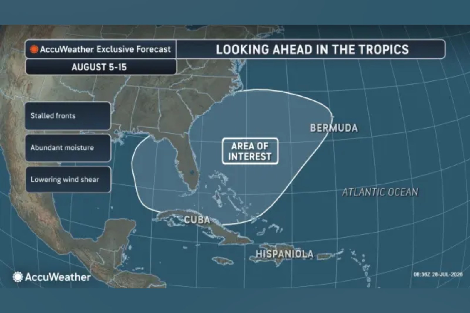
According to AccuWeather, the waters surrounding the southeastern United States might remain a significant area for monitoring potential tropical weather systems into early and mid-August. While there is no immediate tropical activity expected in the Atlantic following storm Bertha, a broad zone near the U.S. coast could become more susceptible as the month progresses.
Area of Interest
The area being watched includes waters around Florida, the Carolinas, Cuba, the Bahamas, and Bermuda. This zone might have the highest chance of producing a tropical depression or tropical rainstorm later in the first week of August and into the second week, although no activity is expected during the initial days of the month.
This situation is being closely monitored due to lower pressure expected in the region compared to surrounding areas, which might aid in thunderstorm development. AccuWeather Lead Hurricane Expert Alex DaSilva mentioned that fronts moving into the region are likely to gradually weaken, with warm waters supporting tropical activity and wind shear possibly reducing for a while compared to earlier in the summer.
Potential Development
AccuWeather suggests one possible development pathway involves a cluster of thunderstorms organizing into an area of low pressure and then detaching from a decaying front. If this occurs, the system could develop tropical characteristics, such as a warm core and rotation, instead of behaving like a typical non-tropical storm influenced by temperature contrasts along a front.
The concern is not a guaranteed storm but the proximity of the risk zone to land. DaSilva noted that the area needs monitoring as tropical storms could form with minimal notice near the coast.
A rapidly developing storm could result in sudden heavy rain, worsening beach conditions, coastal flooding, and damaging winds, according to AccuWeather.
Atlantic Hurricane Season Forecasts
AccuWeather anticipates a below-average to average Atlantic hurricane season in 2026, attributed to a strong El Niño, known to suppress Atlantic tropical activity. The National Oceanic and Atmospheric Administration (NOAA) also predicted a below-normal hurricane season, giving a 55 percent chance of a below-normal season, a 35 percent chance of a near-normal season, and a 10 percent chance of an above-normal season.
The agency forecast includes eight to 14 named storms, with three to six hurricanes and one to three major hurricanes, based on 70 percent confidence in these ranges. An average Atlantic season typically produces 14 named storms, seven hurricanes, and three major hurricanes.
Hurricane Season Storm Names
The official 2026 Atlantic storm-name list released by the National Hurricane Center (NHC) is as follows: Arthur, Bertha, Cristobal, Dolly, Edouard, Fay, Gonzalo, Hanna, Isaias, Josephine, Kyle, Leah, Marco, Nana, Omar, Paulette, Rene, Sally, Teddy, Vicky, and Wilfred.
As of Wednesday, the NHC reports no expected tropical cyclone activity in the Atlantic over the next seven days.