
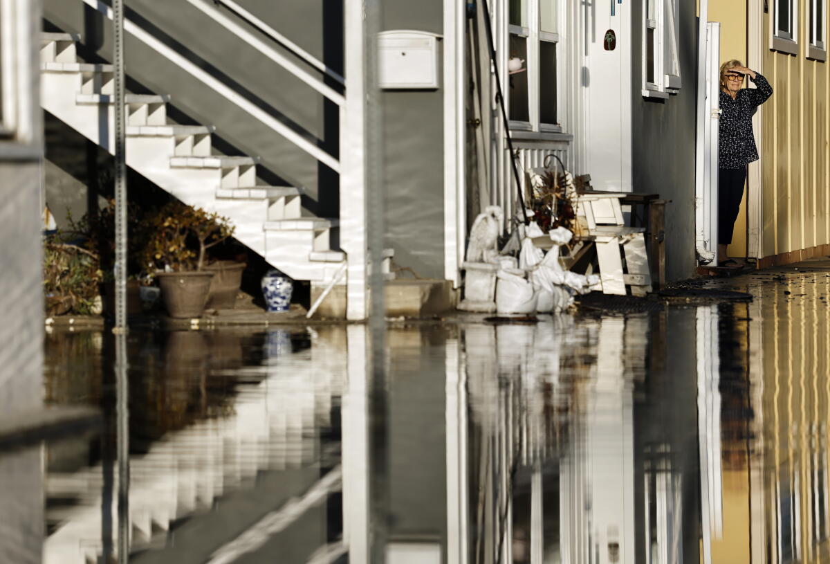
Recent coastal flooding, which impacted areas from Newport Beach to Long Beach, resulted from an uncommon blend of factors. This situation highlights the difficulties California may face with the anticipated “super” El Niño winter.
The recent flooding was notable. Experts indicated how upcoming Tropical Storm Rachel, high tides, exceptionally warm ocean conditions, and waves amplified by El Niño can overwhelm coastal regions. Jonathan Warrick, a research geologist with the U.S. Geological Survey, stated, “The combination of high tides, Kelvin wave, hurricane waves—and then a whole summer worth of that? This is unprecedented.” He predicts similar conditions may recur, with a lengthy El Niño season ahead and a potential succession of winter storms and king tides during the holidays.
Tropical Storm Rachel’s center was expected to reach northern Baja California by Saturday night. The San Diego office indicated that the highest flooding risks for Orange County and San Diego coastlines would be on Sunday morning, due to swells, onshore winds, and high tides. High tide times were noted at 9:43 a.m. in La Jolla and 9:48 a.m. in Newport Beach.
Coastal flooding this week might offer insights into the upcoming season. Jonathan Warrick clarified, “I won’t say 100% sure we’re going to see this this winter, but this is a type of thing we may see a lot more of this winter.” He added that such events are likely to increase in the coming decades with ongoing sea level rise.
California experiences its highest tides of the year around the summer and winter solstices, with some expected on Thanksgiving Day, Christmas Eve, and January 22. If these align with strong winter storms, coastal erosion and damage may occur, according to UC San Diego Scripps Institution of Oceanography researcher Reinhard Flick.
Every 18.6 and 4.4 years, exceptionally large tides occur, and California is nearing those peaks. Mark Merrifield from Scripps’ Center for Climate Change Impacts and Adaptation warned of strong king tides this Christmas, enhanced by El Niño’s elevated sea levels.
El Niño, characterized by unusual warmth in the central and eastern equatorial Pacific Ocean, usually leads to increased Southern California precipitation. Two of the strongest El Niños in the past 75 years caused significant damage to Southern California’s coastlines, resulting in battered homes, flooded streets, and damaged piers. Another instance resulted in record coastal erosion without increased rainfall.
This week’s Orange County flooding seemingly stemmed from both Tropical Storm Rachel’s swells and an El Niño-fueled Kelvin wave moving from Peru at 6 miles per hour. Although invisible at the surface, it can raise sea levels by up to 12 inches. Warmer water expanding due to its heat can further boost sea levels.
Jonathan Warrick reflected on the unprecedented situation, “I mean, I grew up down there. I was on Newport Beach every day, you know, when I was a kid, and I’ve never seen anything like this. This is completely unprecedented. It’s shocking.”
This Kelvin wave might keep sea levels elevated for several months, according to Dillon Amaya, North Carolina State University’s assistant professor. Another Kelvin wave heading up the coast of Mexico could affect Southern California within weeks.
Amaya explained the interaction, “The hurricane is definitely the triggering factor in terms of providing the storm surge, but the Kelvin wave almost certainly conditioned the background sea state such that flooding was more dangerous this time.”
City officials have been busy preparing for Rachel, constructing sand berms and fortifying vulnerable zones with sandbags. On Saturday morning, tide levels in Los Angeles Harbor peaked at 7.7 feet, 1.6 feet above predictions. The upcoming Sunday morning’s high tides of around 8 feet could challenge or surpass recent record tide levels in L.A. County.
Historically, only two tropical storms have impacted California’s coast at tropical-storm strength. El Cordonazo hit Long Beach and San Pedro in September 1939, causing 45 deaths from flooding and 48 more at sea. In September 1997, Nora passed along the California-Arizona border, sparing California severe damage.
This year’s El Niño season is predicted to be exceptionally strong. NOAA’s Climate Prediction Center announced nearly a 100% probability that it will reach a “very strong” classification. The chance of it being the strongest on record, dating back to 1950, increased to 83% from last month’s 75% forecast.