Millions in Texas, Louisiana, and Mississippi face flood alerts this week. Heavy rains create dangerous flash flooding risks across the Gulf Coast and Lower Mississippi Valley.
Severe Rainfall and Flash Floods
Forecasters warn that some areas might experience several inches of rain in a few hours. This can overwhelm drainage systems and flood roads, triggering water rescues in severely affected locations. Many regions, already soaked from previous rainfall, are unable to absorb more water, increasing the flood threat. Areas not usually affected by floods might experience severe conditions if storms repeatedly hit them.
Texas: Epicenter of Flooding Concerns
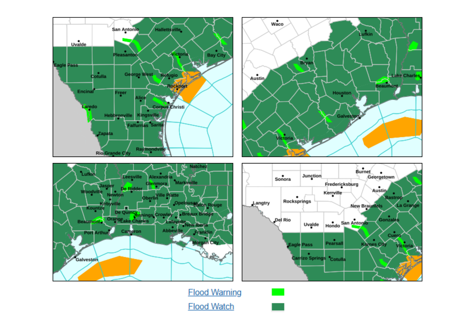
Texas is at the center of this threat. South Texas is under flash flood warnings, while broader flood watches cover south, southeast, and south-central Texas through Thursday. Some areas have already seen 4 to 6 inches of rain. An additional 4 to 10 inches are possible with isolated incidents exceeding 12 inches if storms persist. Rainfall rates of 2 to 5 inches per hour can occur in stronger storms.
Louisiana Prepares for Ongoing Rain
Much of Louisiana is under flood watches through at least Thursday and possibly Friday. Forecasters predict rounds of thunderstorms with widespread rainfall of 3 to 6 inches and higher in some places. River levels are also a concern, particularly the Mermentau River, expected to hit minor flood stage later this week.
Mississippi’s Flood Risk
Flood watches cover much of Mississippi through Thursday. Repeated thunderstorms may bring 3 to 5 inches of rain quickly, with some areas seeing even higher totals.
Factors Behind the Flood Threat
Several elements lead to this dangerous situation: saturated ground, repeated thunderstorms, and high rainfall rates. Rainfall could reach 2 to 4 inches per hour during intense storms, with widespread totals of 4 to 6 inches expected by Thursday. Along the Texas Gulf Coast, higher totals are possible as storms might hit the same areas, increasing flash flood risks.
Potential Impacts
The National Weather Service cautions that excessive runoff could flood roads, neighborhoods, rivers, and low-lying areas, especially where drainage is poor. Flash flooding can occur suddenly, making travel risky and potentially trapping drivers. Continuous rain may also elevate the risk of river flooding later in the week. Emergency crews in Texas have already dealt with stranded vehicles and conducted water rescues.
Safety Recommendations for Residents
The NWS advises drivers to “Turn Around, Don’t Drown” when faced with flooded roads. Other expert recommendations include:
- Stay informed about weather conditions and local alerts.
- Avoid travel during heavy rainfall.
- Move to higher ground if flooding begins.
- Keep emergency supplies ready.
Duration of the Flood Threat
Flood risks across Texas, Louisiana, and Mississippi will likely continue through Thursday, with conditions slowly changing but not significantly improving.
Texas
Heavy rain is expected through Thursday, mainly along the Gulf Coast, where repeated storms and tropical moisture increase flash flooding potential.
Louisiana
Flood risk remains significant through Thursday or Friday due to multiple rain rounds, which keep soils saturated, heightening flash and river flooding possibilities.
Mississippi
Flood concerns persist into Thursday. Central and southern areas face risks of heavy downpours and flash flooding. While conditions might improve as the week ends, any additional heavy rain could exacerbate flooding in already saturated regions.