
The Atlantic Ocean is experiencing an unusually quiet hurricane season, attributed to a strong El Niño effect. According to the National Hurricane Center, no hurricanes have formed yet in the Atlantic this year. The season typically peaks from August to October but has seen only five weak tropical storms thus far.
On Saturday, 2026 set a record for the longest the season has begun without a storm reaching 64 mph winds, qualifying as a hurricane, at least since the satellite era started. Prior to the 1950s, some years recorded no hurricanes this late, though these records are considered unreliable due to incomplete ocean monitoring.
Phil Klotzbach, a hurricane expert from Colorado State University, noted that overall hurricane activity in the Atlantic is at a record post-1950 low, with storm activity only 7% of normal levels for this time of year. The annual hurricane report from Colorado State University predicted nine named storms in the Atlantic basin.
Despite the quiet season, experts warn that it only takes one storm to cause significant damage, citing 1992’s Hurricane Andrew as a precedent. Smaller storms can also pose dangers.
Kristen Corbosiero, an atmospheric science professor at the University at Albany, highlighted the inhospitable conditions in the Atlantic for storm formation, citing winds that weaken systems, dry air, and downward-pushing winds as deterrents. These factors are classic impacts of El Niño, characterized by the warming of parts of the equatorial Pacific. The last El Niño pattern occurred in 2023, and these events typically happen every two to seven years.
The most significant El Niño effect in the Atlantic involves strong wind shear, where easterly winds clash with storm systems at low levels while westerly winds push at the upper altitudes, tearing storms apart. In regions between Africa and the Caribbean, the wind shear is about 45 mph higher than a tropical cyclone can withstand.
Brian McNoldy, a hurricane expert from the University of Miami, emphasized that storms are halted before they can develop properly. While conditions in the Gulf of Mexico may permit storm formations later in the season, the presence of dry air and African dust further complicate storm development.
Despite this, the world’s oceans have experienced record high temperatures for over 100 days. Yet the temperature of the Atlantic waters hasn’t increased as rapidly as the air above, linked to El Niño’s impact. Kerry Emanuel from the Massachusetts Institute of Technology points out that the heat flow from ocean to air determines hurricane activity. With the waters lagging behind atmospheric warming, the current season is quieter.
The expectation is for next year’s hurricane season to be busier after El Niño dissipates, maintaining warm waters that could fuel storms more effectively.
Contrasting the Atlantic, the Pacific Ocean is seeing heightened tropical cyclone activity. The eastern Pacific has experienced double the usual storm activity, and the central Pacific is 40% above normal levels. Hurricanes here last longer and occur frequently.
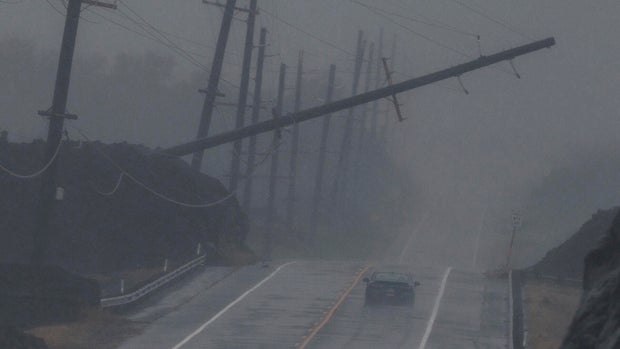
Hawaii, hit by tropical activity twice, experienced widespread damages, including power outages and heavy rains. In August, Hurricane Lala caused substantial impact despite bypassing landfall.
El Niño generally intensifies storm activity in the Pacific while mitigating it in the Atlantic, as experts predicted a slower Atlantic hurricane season. The subdued activity, however, has surprised even seasoned forecasters.