
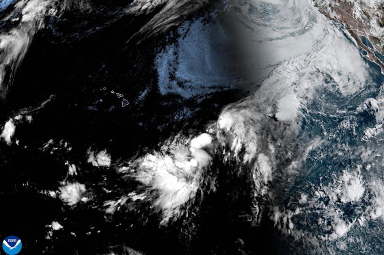
Hernan, a newly formed Tropical Storm in the Pacific Ocean, was approximately 1,460 miles west of the southern tip of Baja California, Mexico, according to reports from the National Hurricane Center. As of the latest updates, the storm posed no threat to land. Sustained winds were estimated at 40 mph as Hernan moved westward.
In contrast, a different storm system, identified as Potential Tropical Cyclone One-C, was about 775 miles east-southeast of Hawaii. This system could impact the Hawaiian Islands with heavy rain, high winds, and dangerous surf beginning late Friday.
The system’s current winds were also around 40 mph, but it lacked the organization to be classified as a tropical storm. Forecasters predicted that it might make landfall on the Big Island’s southern region as a tropical storm by Saturday.
Projected rainfall totals for the Hawaiian island chain ranged from 5 to 10 inches, with potential highs of 20 inches. Such conditions could lead to flooding and mudslides, as cautioned by the weather center.
In the Atlantic, Tropical Storm Cristobal had weakened into a tropical depression. It was anticipated to dissipate by Thursday. Located approximately 610 miles west of the Azores, Cristobal did not pose a land threat according to the center’s report.