
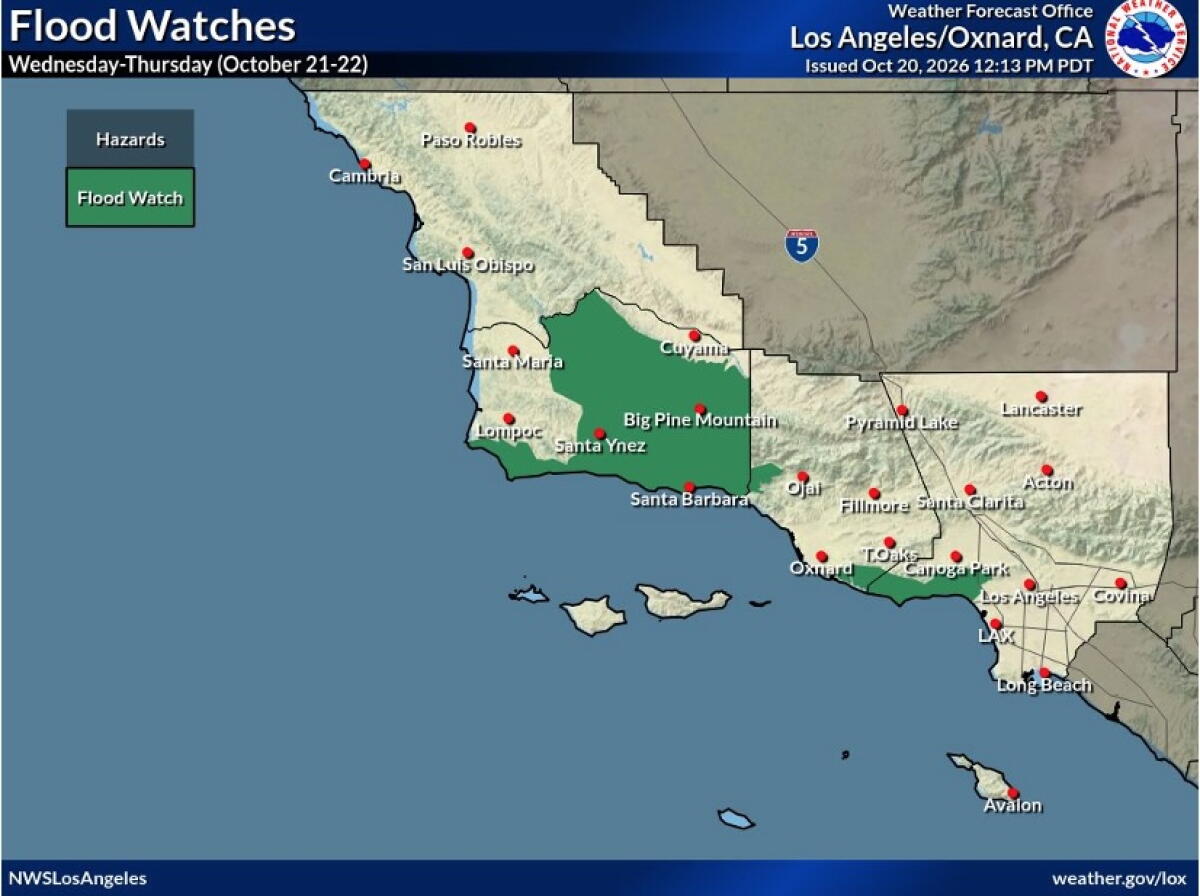
Southern California is expected to experience rain from Wednesday into Thursday. The National Weather Service has issued cautions for potential beach hazards and thunderstorms stretching from Oxnard to the Mexico border.
The Los Angeles-Oxnard office predicts a 30% to 40% chance of thunderstorms. Concerns include widespread minor flooding and debris flow, particularly affecting Los Angeles and Ventura counties. Despite this, most areas will likely see only minor impacts.
The Santa Monica Mountains face the highest flood risk. A spokesperson notes that first-year burn scars, such as those in Palisades and Altadena, are especially vulnerable.
Regarding rainfall, the Los Angeles office expects specific amounts: 1.73 inches in Thousand Oaks, 1.53 inches in Oxnard, 1.47 inches in Santa Clarita, 1.31 inches at LAX, 1.29 inches in Covina, and just under an inch in Long Beach.
For beach conditions, the Los Angeles County and Oxnard region should anticipate surf ranging from 3 to 6 feet until Thursday night on south- and southwest-facing beaches. Tides are predicted to be between 5.5 and 6.2 feet.
The San Diego office issued a beach hazard warning, effective until 11 p.m. on Tuesday. It warns of dangerous rip currents and breaking waves with 3 to 6 feet surf. South- and southwest-facing beaches will have the highest surf.
Severe rip currents can pull swimmers and surfers out to sea, while waves may wash people off beaches and rocks, posing risks to small boats near the shore. The weather service advises staying out of the water to avoid hazardous conditions.
Wednesday morning and afternoon rain chances are 53% in Irvine and Anaheim, 46% in San Clemente, 44% in Ontario, and 40% in Riverside. Evening into Thursday morning shows higher chances: 95% in Anaheim, Irvine, and San Clemente, 92% in Ontario, 91% in Riverside and Lake Elsinore, and 88% in San Bernardino.
San Diego’s weather service warns of a 15% to 25% moderate risk of thunderstorms across the four counties.