
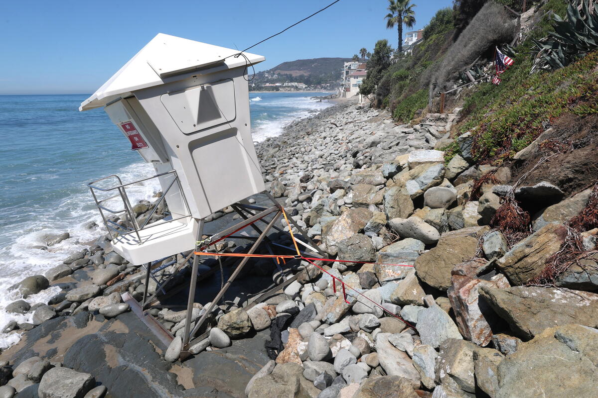
Current Damage Assessment
Coastal areas in Southern California are dealing with the aftermath of flooding and waves as they prepare for further challenges posed by a “coastally trapped Kelvin wave.” Homes from south Orange County to Malibu have experienced significant flooding and damage. Erosion has severely impacted regions from Carlsbad to Long Beach.
Cities such as Laguna Beach, Dana Point, and Carlsbad declared a local state of emergency due to coastal erosion and sand loss caused by the south swell from Hurricane Marie. El Niño conditions often lead to an active hurricane season in the eastern Pacific, with Hurricane Marie being one such example.
“I’d been chatting with other cities and city managers up and down the coast, and I think we all had different levels of damage,” Laguna Beach City Manager Dave Kiff remarked.
He noted Laguna Beach experienced significant damage; sand replenishment remains a concern for coastal communities. Efforts are underway to replenish sand from Newport to Huntington to Seal Beach, extending further south.
In Orange County, officials mobilized emergency response efforts after two cities declared local emergencies, highlighting severe coastal damage. A video showed erosion threatening train tracks used by Metrolink in San Clemente.
Carlsbad declared a local emergency to protect Carlsbad Boulevard, known as Old Highway 101, from erosion. In Dana Point, waves impacted homes along Beach Road.
Forecasts and Upcoming Challenges
An incoming “coastally trapped Kelvin wave” presents further challenges for the U.S. West Coast. Winter could bring more storms as forecasters suggest a 75% chance of a stronger El Niño than any recorded since 1950. There is a 98% probability of a “very strong” El Niño through December, as per the National Oceanic and Atmospheric Administration’s Climate Prediction Center.
Understanding Kelvin Waves
Kelvin waves, integral to El Niño, involve warming ocean waters in the Pacific, affecting global weather patterns. The waves, “coastally trapped,” follow coastal boundaries with the shore to their right in the Northern Hemisphere.
Recent advancements allow scientists like Dillon Amaya to model and track these waves. The ongoing El Niño, one of the largest recorded, corresponds with large coastal waves.
As El Niño unfolds, east-to-west trade winds along the equator weaken or reverse; this allows warm water from the western Pacific to move east. This oceanic shift typically warms cooler Pacific areas, aided by Kelvin waves that travel equatorially and split upon reaching South America.
Rising Sea Levels
Kelvin waves, once coastally trapped, raise sea levels, increase ocean temperatures, and push nutrient-rich waters deeper. These waves can elevate sea levels by about 6 to 12 inches for several months, heightening flood and erosion risks when combined with storms.
“Elevated sea levels substantially increase flood risk and beach erosion,” Amaya observed.
Recent events in Long Beach demonstrate the destructive potential when high tides and hurricane swells converge.
Timeline and Arrival
The coastally trapped wave, currently along Mexico’s west coast, is anticipated to enter the Gulf of California soon. It will take approximately 11 days to navigate the gulf’s U-shape and another seven days to travel from Cabo San Lucas to San Diego.
From San Diego, it will move to L.A. in two to three days, reaching San Francisco two to three days later. Southern California could experience wave impacts by early October, though exact timing is uncertain.
“They travel about 25,000 kilometers up to the Gulf of Alaska, taking nearly 120 days,” Amaya explained.
Potential Impact
The wave is expected to raise sea levels off California’s coast by another 6 inches, with effects lasting months. While minor, this rise could exacerbate current coastal challenges, especially if additional storms occur.
Jonathan Warrick of the U.S. Geological Survey emphasized the danger given recent high tides and hurricane swells, noting elevated water levels can trigger severe damage.
California has seen about a foot of sea level rise linked to global warming and polar ice melting over 125 years. Increased tide levels add to the complexity of managing coastal impacts.