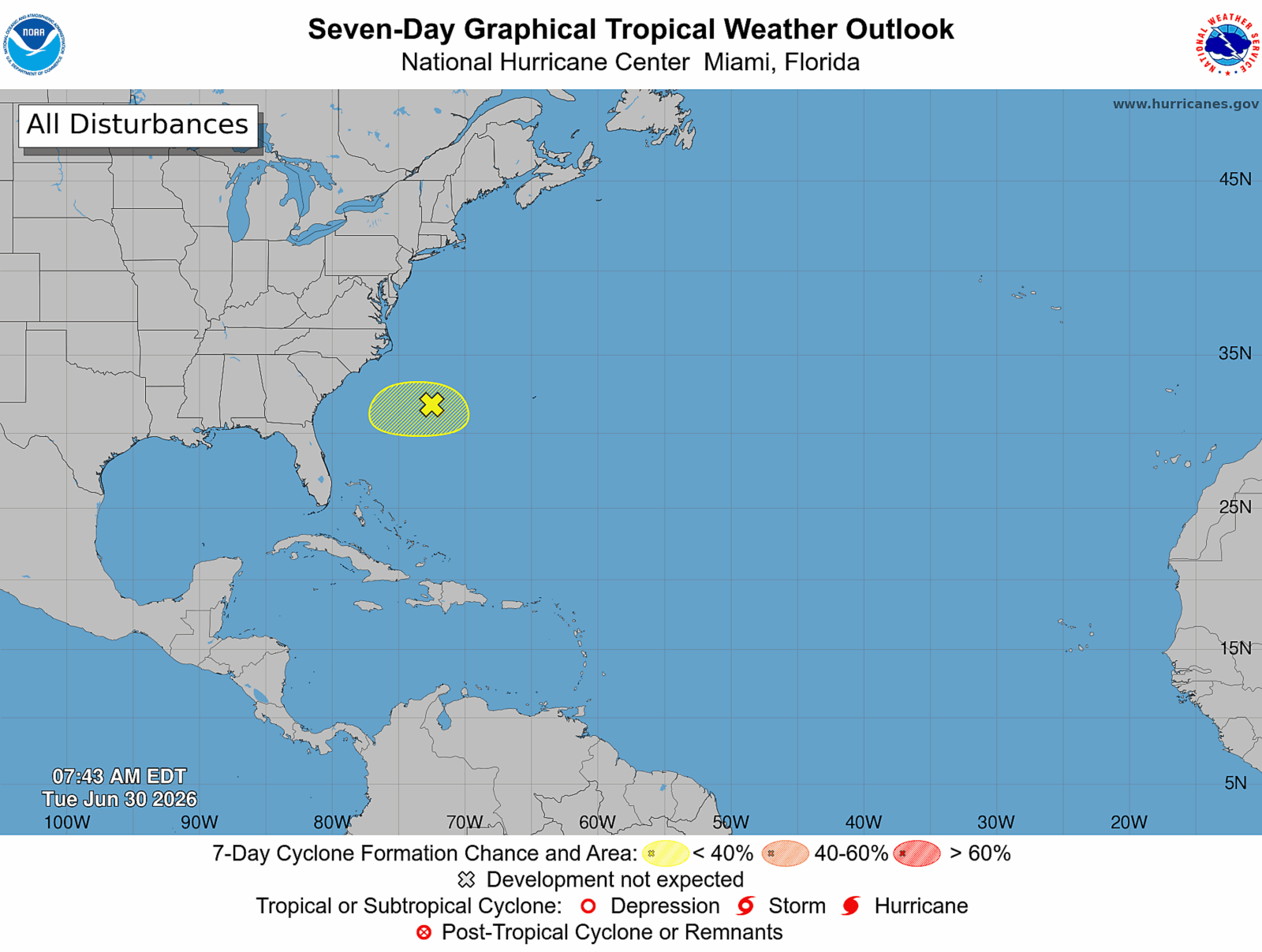
A developing low-pressure system near the southeastern U.S. coast may become Tropical Storm Bertha, moving towards Florida this week. The National Hurricane Center (NHC) is watching closely, though current probabilities for tropical development are low.
The latest Tropical Weather Outlook from the NHC indicates only a 10% chance of tropical formation within the next 48 hours. The system is poorly organized, and as it nears Florida, conditions are not supportive of significant strengthening. Nevertheless, if it organizes sufficiently, it will be named Bertha, the second named storm for the 2026 Atlantic hurricane season.
The NHC has observed the disturbance moving south, expected to shift west later in the week. According to AccuWeather Lead Hurricane Expert Alex DaSilva, crucial time for potential tropical development is mid-week, specifically on Wednesday or Thursday.
NOAA anticipates a quieter Atlantic hurricane season, with expected counts of 8 to 14 named storms, including 3 to 6 hurricanes and 1 to 3 major hurricanes. Even a below-average season could result in significant storms. There is a 55% likelihood of below-normal activity, due largely to El Niño conditions which increase wind shear, hindering storm development.
Hurricanes require a calm, aligned atmosphere to develop, conditions interrupted by El Niño’s stronger upper-level winds. These winds affect thunderstorms and the formation of tropical cyclones, decreasing the number of Atlantic hurricanes in such years.
DaSilva mentioned current low wind shear but highlighted dry air from a cold front limiting development. Additionally, widespread heat is contributing to drying the system, making formation less likely. As the disturbance nears the Gulf Stream, where waters are warmer, potential exists for it to become a tropical depression.
Should a depression form, it will likely happen by July 1 or 2 as the system interacts with the Gulf Stream. However, the disturbance is lacking moisture, with primary concerns being stronger rip currents along the East Coast from Florida to the Carolinas, starting as early as Tuesday afternoon.
As hot conditions drive many to beaches, DaSilva emphasizes ocean safety due to heightened rip currents. Besides the Atlantic disturbance, the NHC is also tracking a Pacific system with an 80% chance of development within 48 hours.