
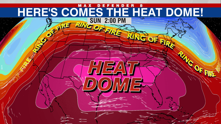
A significant heat event is forecast for the Southeast and Florida due to a near-record heat dome covering the region. Expected to begin this weekend, the intense heat might persist through the following week.
The heat dome, a phenomenon characterized by an area of high pressure, traps warm air and prevents clouds and rain, according to the American Meteorological Society. This particular dome is poised to set monthly high-pressure records, leading to numerous temperature highs and lows.
The National Oceanic and Atmospheric Administration estimates that over 30 million people will face ‘extreme’ heat, while an additional 50 million will experience ‘major’ heat. The heat will intensify as the week progresses, with peak conditions over the weekend.
States under the dome by Sunday include Missouri, Arkansas, Kentucky, Tennessee, southern Illinois, Alabama, Mississippi, Georgia, and Florida. Temperatures in Florida will reach the mid-90s, with other regions stretching from Oklahoma and Texas to the Carolinas hitting around 100 degrees. A heat risk map indicates dangerous heat conditions across many states.
With humid air present, heat indices will rise to between 105 and 115 degrees. Northern lows will remain high, posing further risk. According to meteorologist Jeff Masters from Yale Climate Connections, low overnight temperatures are crucial in managing total heat stress because insufficient cooling at night prevents the body from recovering.
Despite the heaviest heat this weekend and into next week, the heat dome might linger into the subsequent weekend. This follows a recent record set in July as the hottest month in the contiguous United States, with an average of 76.89 degrees Fahrenheit, surpassing the Dust Bowl’s July 1936 by a slim margin.
Masters stated that surpassing Dust Bowl records signals significant concern, referencing the historic heat and drought that prompted massive migration and marked a tumultuous period in U.S. history, indicating serious contemporary issues.