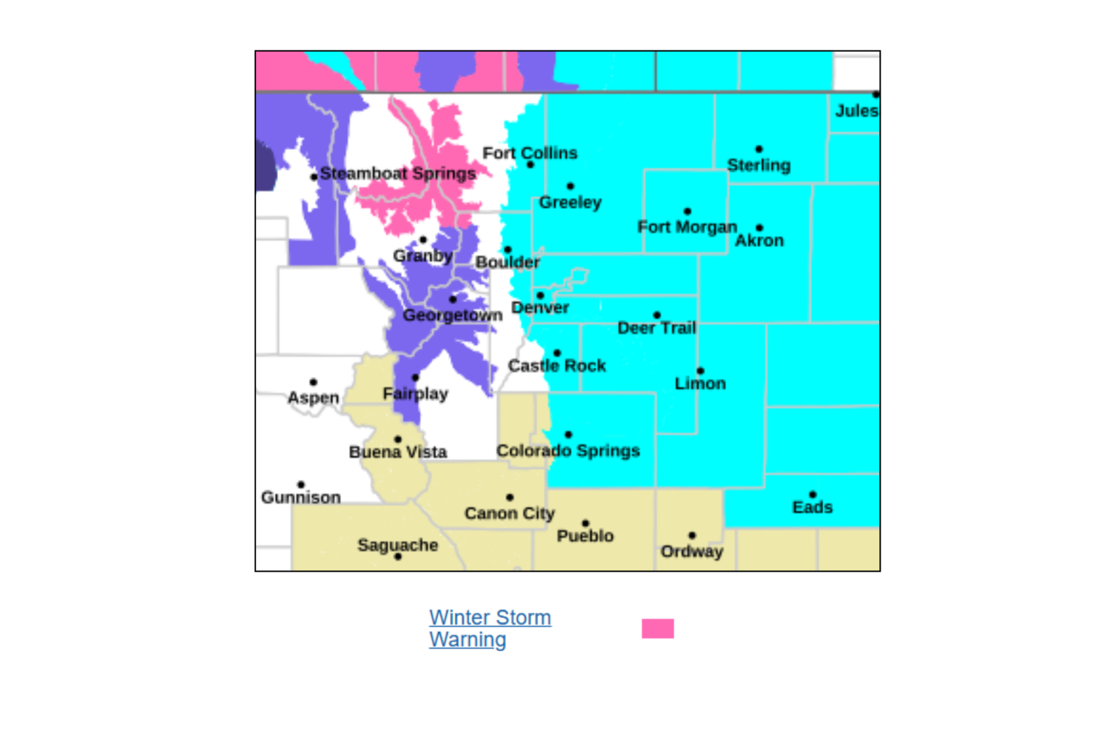
A significant winter storm is forecasted to strike parts of Wyoming and Colorado, with potential snow accumulations reaching up to 20 inches, coupled with wind gusts reaching 60 mph. According to the National Weather Service (NWS), these conditions will likely lead to hazardous travel, severely reduced visibility, and possible power outages due to heavy, wet snow affecting trees and power lines.
Local Impacts: Power, Trees, and Daily Disruptions
This storm could disrupt daily life, particularly in affected communities where:
- Power outages may occur because of snow-laden tree limbs affecting power infrastructure.
- The Monday commute could be significantly impacted in both mornings and evenings.
- Access to rural and mountainous areas will likely be challenging.
- School operations and local services might face delays or interruptions, especially in higher-elevation regions.
- Outdoor work and activities could become hazardous.
- Tree damage could occur, notably in places where trees have begun their spring growth.
Winter Storm Overview: The Hardest-Hit Areas
The NWS has issued warnings for large areas of Wyoming and Northern Colorado, prioritizing higher elevations and mountain regions. Severely impacted zones include:
- Colorado (above 9,000 feet): Rocky Mountain National Park, Medicine Bow Mountains, Rabbit Ears Range, and surrounding Mountain Passes.
- Wyoming: Snowy Range, north Laramie Ranges, Wind River Mountains, Sierra Madre Range, Casper Mountain, and Interstate 80 corridor near Arlington and Elk Mountain.
Forecast Winter Weather Conditions
- Heavy, wet snow may adhere to trees and infrastructure.
- Wind speeds between 30 and 60 mph.
- Blowing and drifting snow will likely hamper visibility.
- Conditions are expected to deteriorate rapidly from Sunday night into Monday.
How Much Snow Is Expected?
Snowfall will vary considerably based on elevation and location, with notable accumulations projected:
- Colorado: Rocky Mountain National Park and Medicine Bow Range could receive between 8 and 18 inches, with east-facing slopes getting the highest totals.
- Wyoming: Snowy Range and north Laramie Range might see 10 to 20 inches, with wind speeds up to 40 mph causing snow drifts above 8,500 feet. Wind River Mountains (East) could receive 9 to 18 inches, with gusts reaching 60 mph. Casper Mountain may face 10 to 18 inches, with 40 mph winds leading to reduced visibility. Sierra Madre Range could have up to 15 inches, with wind gusts up to 50 mph causing blowing snow.
Snow Warnings: What Should Drivers Expect?
Travel could become challenging, particularly in high-elevation areas and major routes, with dangers including:
- Snow-covered and icy roads, especially bridges and overpasses.
- Blowing snow and potential whiteout conditions.
- Visibility may drop suddenly, sometimes below a quarter of a mile.
- Higher risk of vehicles becoming stranded.
Major routes affected include Interstate 80 in Wyoming near Arlington, Elk Mountain, and the Laramie Range. Additionally, Highway 20 to 26 between Hiland and Casper, Wyoming, as well as mountain passes like Cameron Pass, Willow Creek Pass in Colorado, and South Pass in Wyoming. The NWS advises delaying travel if possible. If travel is necessary, drivers should:
- Carry emergency supplies such as food, shovels, water, and a flashlight.
- Allow additional time and space between vehicles.
- Be prepared for swiftly changing conditions.
Key Takeaway
This storm poses serious challenges, with heavy snow, high winds, and extensive travel risks threatening Wyoming and Northern Colorado. Residents in these areas should take precautions and avoid unnecessary travel, as conditions will likely worsen through Monday.