
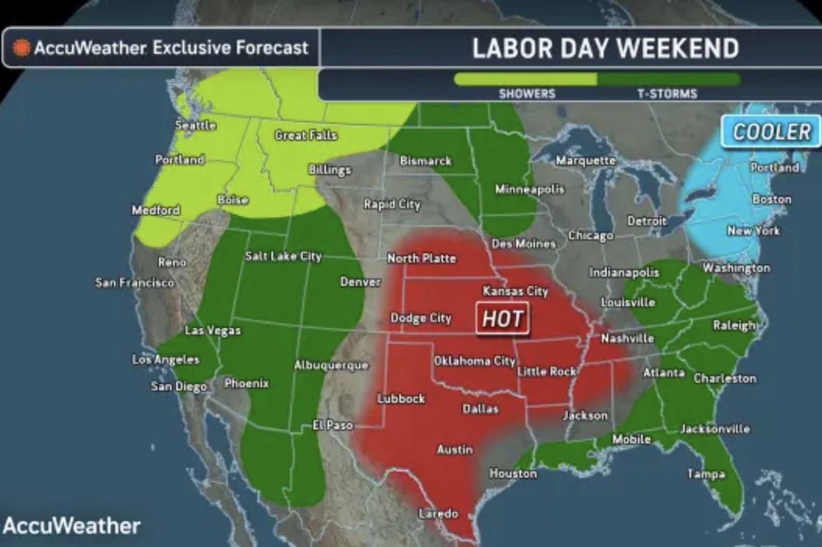
As Labor Day weekend approaches, weather extremes pose challenges across the United States. The central U.S. faces severe heat, while storms may cause flash flooding from the West to the Southeast.
Extreme Heat Threatens Central States
The National Weather Service (NWS) has issued extreme heat warnings across areas in five states. More than 100 degrees Fahrenheit temperatures are expected in Texas, Oklahoma, Missouri, Tennessee, and Nebraska. High humidity will exacerbate the heat, causing conditions to feel up to 15 degrees hotter than the actual temperature.
According to AccuWeather, a heat dome is responsible for this intense heat. This dome spans the central and southern Plains and the Mississippi Valley. The NWS forecasts increased temperatures in the middle Mississippi Valley, Ohio Valley, and Tennessee Valley from Wednesday. Heat advisories are issued across these regions due to “dangerously hot conditions.” An NWS post described the record warmth as being caused by “a persistent ridge of high pressure and heights in the 80th-99th percentile.”
Storms Impact Areas Beyond the Heat Dome
While central states may remain dry under the heat dome, storm activity is anticipated around its edges. Forecasts predict showers and thunderstorms in the West, northern Plains, Midwest, and Southeast. Some storms could lead to heavy rain, flash flooding, and wind damage.
The NWS predicts that showers and thunderstorms will affect parts of the Southwest starting Wednesday. By Thursday, these storms will intensify. There will also be showers and thunderstorms in the Great Basin and the central and southern Rockies from Wednesday. The lower Great Lakes and northern mid-Atlantic can expect similar weather soon.
Understanding a Heat Dome
A heat dome occurs when a high-pressure system remains stationary, trapping heat and humidity. This situation causes the air to compress, increasing temperatures in the lower atmosphere. The result is a dome of hot air, causing prolonged heat waves.
Michael Muccilli, acting warning coordination meteorologist for NOAA’s Weather Prediction Center, states, “The system’s sinking air combined with abundant sunshine contributes to further warming.” Heat waves linked to high-pressure areas can last one to two weeks and longer in drought conditions.
Flooding Concerns in Texas
Texas faces increased flooding risks following Tropical Storm Edouard. After crossing the state on Tuesday, it weakened to a tropical depression. The NWS forecasts it will reach Northeastern Texas by Wednesday and weaken further by Thursday morning.
However, heavy rainfall in eastern Texas could cause flash flooding in urban areas, roads, small streams, and low-lying zones. Additionally, AccuWeather warns of flash flooding risks, especially around the heat dome in the West, with possible thunderstorm-induced heavy rainfalls.