
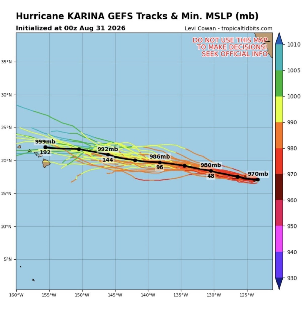
Hurricane Karina has escalated into a Category 4 storm in the eastern Pacific. The National Hurricane Center (NHC) has issued warnings that the swells produced by the hurricane will likely advance toward Southern California. These swells threaten to bring life-threatening surf and rip currents.
“Swells generated by Karina will affect portions of the coast of southwest Mexico and the Baja California Peninsula for the next couple of days and will likely spread northward to southern California on Monday through midweek. These swells are likely to cause life-threatening surf and rip current conditions,” according to the advisory from NOAA’s National Hurricane Center.
While Hurricane Karina itself is not projected to move towards California, the generated swells can travel significant distances. As of late Sunday, Karina’s location was approximately 1,020 miles west-southwest of Baja California’s southern tip, with sustained winds up to 145 mph, moving west at 9 mph. Current forecasts show no coastal warnings in effect from the NHC.
Spaghetti Model Predictions for Hurricane Karina
Data from Tropical Tidbits, a platform specializing in hurricane tracking, indicates Hurricane Karina’s path remains generally westward, distant from Mexico and California. The spaghetti models, such as GEFS, display various potential trajectories for the storm. Understanding these parameters is crucial:
- GEFS: Global Ensemble Forecast System predicts multiple storm paths.
- Tracks: Denotes the projected storm center paths.
- MSLP: Minimum mean sea level pressure, indicating storm strength.
- Units: Atmospheric pressure measured in millibars (mb) or hectopascals (hPa).
Life-Threatening Conditions Possible for Southern California
NHC’s forecast on Monday positions Karina continuing westward with a subsequent turn to the west-northwest. The hurricane remains distant from land.
Swells produced by the hurricane are anticipated to impact southwest Mexico and the Baja California Peninsula initially, spreading northward to Southern California by midweek. These may lead to dangerous surf and rip-current scenarios, per NHC’s alert.
Forecast Indicates Karina Remains Offshore
Karina’s center coordinates were logged at 17.2 degrees north latitude and 124.4 degrees west longitude, moving west around 8 knots. Maximum sustained winds measured at 125 knots, with gusts potentially reaching 150 knots. Strengthening remains possible as of Monday, with intensity variations over the upcoming days.
Beach Safety Reminder
Individuals planning beach trips in Southern California should monitor local weather updates and alerts. The NHC advises consulting local forecasts for specific details concerning potential dangers posed by swells and rip currents.