
Major cities from Los Angeles to Atlanta could experience increased rainfall, flooding, and other challenging weather conditions this winter. These changes are due to the strengthening of El Niño, according to AccuWeather’s lead long-range expert, Paul Pastelok, as reported by Newsweek. Federal forecasters announced the strengthening of this weather phenomenon, stating that there is a greater than 90 percent chance it will become a very strong event during fall and winter.
Understanding El Niño
El Niño represents the warm phase of the El Niño-Southern Oscillation (ENSO), a recurring Pacific climate pattern impacting global weather. Its opposite, La Niña, signifies the cool phase. Typical El Niño effects include stormier conditions in the South and changes in hurricane activity, alongside drier weather in some northern areas.
Historical El Niño events have coincided with significant weather extremes. Notably, the 1997-98 Super El Niño caused severe flooding in California and Peru. The 2015-16 event was linked to global temperature records and widespread climate disruptions.
Winter Weather Changes for U.S. Cities
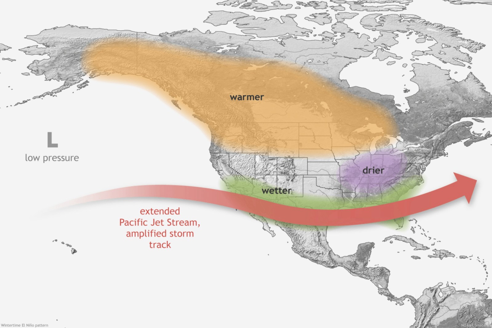
Pastelok highlighted that strong El Niño conditions usually impact cities like Los Angeles, San Francisco, Houston, and Atlanta with more frequent rainfall and potential flooding. A southern storm track often influences these areas, causing frequent weather challenges in late fall and winter. In California, landslides can be a particular concern due to the state’s landscape.
River levels might quickly rise on the Mississippi, across the Tennessee Valley, and the Carolinas, affecting cities along these waterways. Strong El Niño storms could also bring coastal flooding and high winds to East Coast cities such as Norfolk, Virginia, Atlantic City, and Boston.
NOAA’s Winter Outlook
The National Oceanic and Atmospheric Administration’s (NOAA) Climate Prediction Center (CPC) released maps showing temperature and precipitation forecasts for December 2026 through February 2027. These outlooks favor above-normal temperatures over large parts of the country, including the Pacific Northwest, northern Rockies, Plains, Midwest, and Northeast. The strongest warm signals are expected along the northern tier.
Above-normal temperatures are predicted for much of the South, though the forecasts are less certain for California and the Southwest. The precipitation map points to wetter-than-normal conditions from Southern California through the Southwest, southern Plains, Gulf Coast, and extending to Florida and parts of the East Coast.
The CPC’s recent update on El Niño reports a 75 percent chance that the event will reach historic strength between October and December, surpassing past events recorded since 1950. This probability has risen from 69 percent in an August update. A strong El Niño increases the potential for typical weather impacts, though these effects are not guaranteed.