
Expected Development and Path Toward the United States
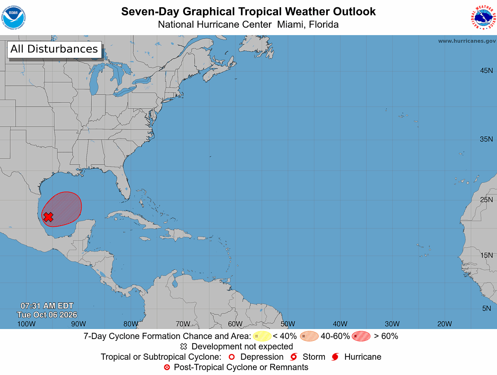
A tropical disturbance in the Gulf of Mexico is anticipated to develop into Tropical Storm Isaias soon. Forecasters are closely tracking its potential path toward the United States. Possible outcomes include flooding rain, storm surge, damaging winds, and isolated tornadoes along the Gulf Coast later this week.
Communities from eastern Louisiana to the Florida Panhandle should monitor forecasts as the storm is expected to approach the northern Gulf Coast by Friday or Saturday.
Monitoring Invest 92L
The National Hurricane Center is observing Invest 92L in the Bay of Campeche, with a high likelihood of tropical development. Hurricane Hunter aircraft are scheduled to examine the disturbance to assess its strengthening pace and eventual landfall location.
Preliminary forecasts indicate the northern Gulf Coast as the major area of concern.
Spaghetti Model Guidance and Landfall Predictions
Tropical Storm Isaias spaghetti model guidance shows numerous tracks converging across the northern Gulf Coast, particularly between eastern Louisiana and the Florida Panhandle. The consensus now focuses on this coastline stretch.
Meteorologists like Matt Devitt and Alex DaSilva suggest the greatest landfall potential lies eastward of eastern Louisiana to the Florida Panhandle, with Mississippi and Alabama’s coastline presenting the highest risks.
Potential Intensity and Path Variables
Though tropical development is expected, uncertainty persists regarding Isaias’s potential intensity prior to reaching the coast. Favorable Gulf water temperatures and significant wind shear are pivotal to its strength.
Experts caution the forecast could change if conditions become more supportive of intensification.
AccuWeather anticipates Isaias may reach hurricane status on Friday, yet increased wind shear near the northern Gulf Coast could weaken the storm before landfall.
Threats from Flooding, Rain, and Storm Surge
Forecasters warn that water hazards could be the storm’s greatest threat, especially flooding rain concentrated east of its center. Rainfall totals could range from 1 to 4 inches, with localized amounts greater in certain rain bands.
Concerns are heightened due to previous rain rounds causing potential runoff issues.
Persistent onshore winds might prompt storm surge along vulnerable coasts.
Tornado Risk and Wind Forecast
Tornado threats exist with tropically induced tornadoes expected, particularly to the east of the storm’s center. Wind gusts of 40-60 mph are expected around landfall zones, potentially rising to 60-80 mph along the coast.
Expect power outages and some property damage close to coastal areas.
National Hurricane Center Updates
The system remains classified as Invest 92L as its organization in the southwestern Gulf improves. Hurricane Hunter aircraft reconnaissance can offer insights into the storm’s strength and trajectory.
If conditions meet tropical storm criteria, Isaias will become the ninth named storm of the 2026 Atlantic hurricane season.
Residents are advised to review their hurricane preparations and evacuation plans.
Being over-prepared is better than underprepared, with familiarity of local evacuation zones recommended.