
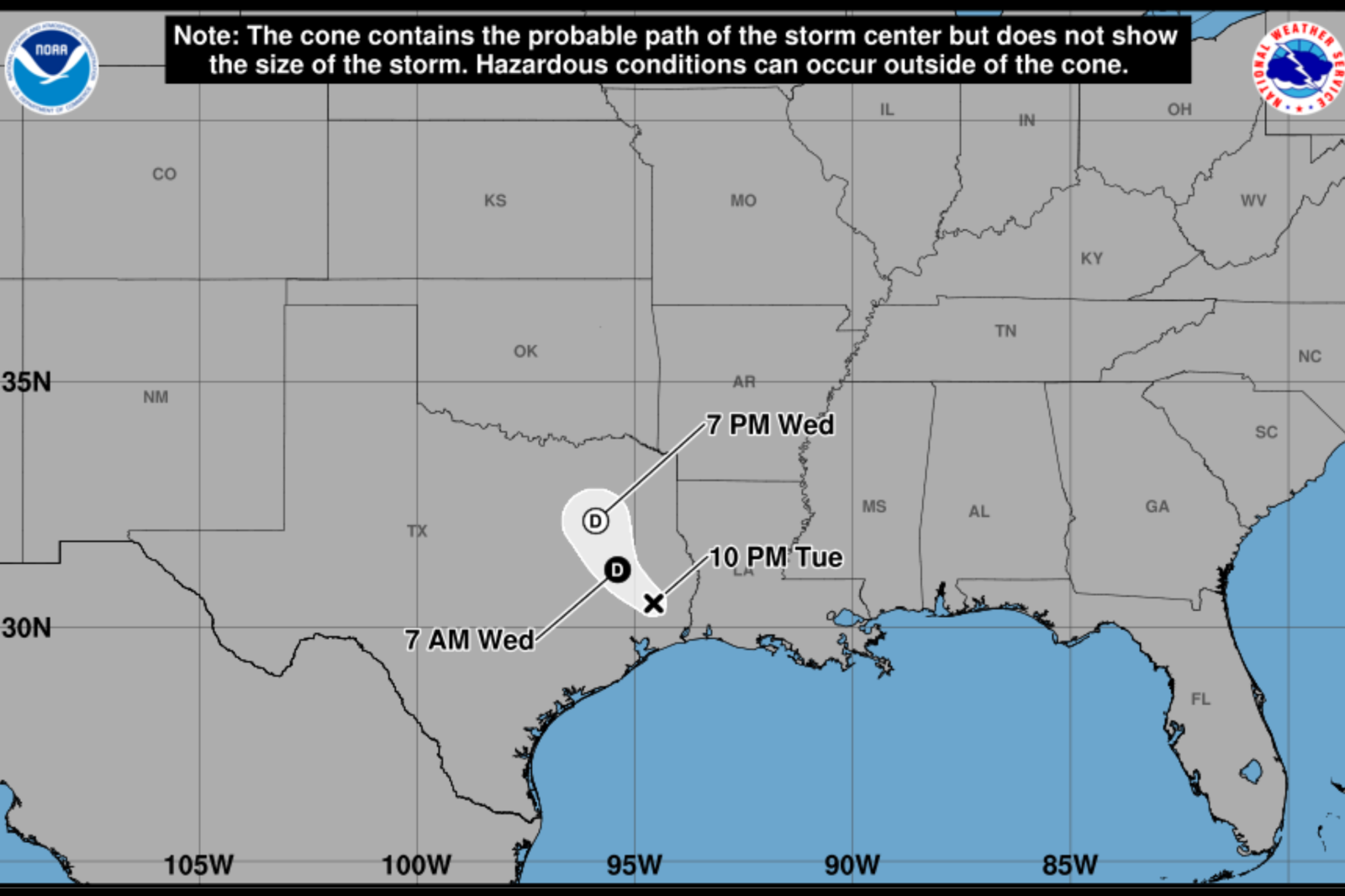
Tropical Storm Edouard, now a tropical depression, is causing significant concern in Texas due to heavy rain and potential flooding. As Edouard moves inland from the Gulf Coast, it continues to bring widespread rainfall, raising the threat of dangerous flash flooding in various parts of the state.
Tracking the Storm
The latest models show Edouard moving northward through eastern and central Texas. The heaviest rain is expected to extend from the upper Texas coast inland. While the precise path of the storm’s remnants remains uncertain, forecasts highlight a broad impact zone from the Gulf Coast into eastern and central Texas, where flooding risks are most pronounced.
From Wind Threat to Rain Hazard
According to the National Hurricane Center (NHC), while tropical storm force wind gusts are possible near the storm’s center, heavy rainfall has become the primary hazard. The NHC warns that river and flash flooding, particularly in urban areas, is likely as the storm progresses inland across Texas and into southwest Louisiana.
Preparation and Response
Communities across southeast Texas are preparing for Edouard’s impact. In Montgomery County, emergency teams have readied equipment and secured additional resources, including rescue boats. Schools such as Conroe ISD and Willis ISD have canceled classes, and some government offices have closed in anticipation of the storm.
Jason Millsaps, director of the Montgomery County Office of Homeland Security and Emergency Management, expressed concerns about heavy rain bands that could remain stationary, leading to significant rainfall accumulation. Barricades have been placed at flood-prone locations throughout the county.
Widespread Flood Watches
The National Weather Service (NWS) has issued Flood Watches for large parts of northeast, east-central, and southeast Texas. In areas like Henderson County, up to 3 inches of rain is expected through Thursday night, with isolated totals reaching 6 inches. Excessive runoff could flood rivers, creeks, streams, and low-lying areas.
Further south and east, a broader Flood Watch covers multiple counties with forecast rainfall totals of 3 to 6 inches. Some areas could see between 10 and 15 inches, especially along and east of Interstate 45. Intense downpours might result in rainfall rates exceeding 3 to 4 inches per hour.
Ongoing Concerns
Edouard’s remnants will continue inland through Wednesday and Thursday, contributing to moderate to heavy rainfall across eastern Texas. Despite weakening, flood risks persist, as saturated areas face repeated rainfall.
Emergency officials advise residents to monitor forecasts and heed flood warnings if necessary. Authorities emphasize that drivers should avoid crossing flooded roads due to uncertain water depths and rapidly changing conditions.
The Texas governor’s office released a statement on August 31 regarding state preparations for the tropical weather threat. The main concern with Edouard is not wind but heavy rainfall, which may inundate roads and communities even after the storm weakens.