
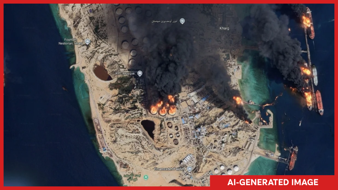
Google introduced a feature on its Google Earth platform that enabled users to create AI-generated satellite images. The feature was short-lived as it was removed following concerns about misuse.
Feature Launch and Removal
The company launched the new tool, allowing users to generate images by entering any desired scene on their screens. This tool aimed to enhance user creativity.
“We’ve seen geospatial professionals using this feature for a range of useful purposes,” Google mentioned in a statement on X.
However, Google soon noticed misuse, with users creating and sharing imagery that violated policies, leading to the tool’s removal.
Concerns of Misinformation
Experts voiced significant concerns over this tool’s potential misuse. They feared that it could produce deceptive satellite images, undermining efforts to verify real events globally. For instance, generating unrealistic scenes like fires on Iran’s Kharg Island posed a threat to factual reporting.
“I tried refugees at the Mexican border, a nuclear plant in Iran,” said Henk van Ess, a researcher.
These fabricated images attracted online journalists and analysts’ attention, sparking debates over the tool’s safety and credibility implications.
Challenge of Deepfakes
Satellite imagery plays a critical role in verifying events. Traditionally considered hard to fake, it is now challenged by the presence of deepfakes. Instances like fake images of a U.S. base in Bahrain highlight this growing issue.
Jake Godin, a researcher with Bellingcat, emphasized this threat. The instant creation of fake satellite images might spread misinformation rapidly.
Google’s Response
Despite these concerns, Google assured users that images are marked with a SynthID watermark. This helps flag AI-generated images in other tools.
“We prevent image creation on harmful topics,” the company stated.
Nevertheless, reassurance in the open-source community was limited, with Google Earth previously esteemed as a reliable source for verifying social media content.
For experts like van Ess, Google’s AI development created a paradox. He noted that integrating AI with Google Earth could blur the lines between reality and fabrication, complicating truth verification.