
The National Hurricane Center (NHC) is keeping a close watch on five potential tropical developments across the Atlantic and Pacific oceans. This includes two tropical waves in the Atlantic basin which might become tropical depressions later as the 2026 hurricane season progresses.
Current Atlantic and Pacific Observations
At present, no tropical cyclones are active in either ocean basin. However, the NHC is focusing on a range of disturbances. These disturbances stretch from the coast of Africa to the waters east of Hawaii. Among these, the NHC highlights an Atlantic disturbance with a 40 percent chance of development within the next seven days.
Two Atlantic Systems Under Watch
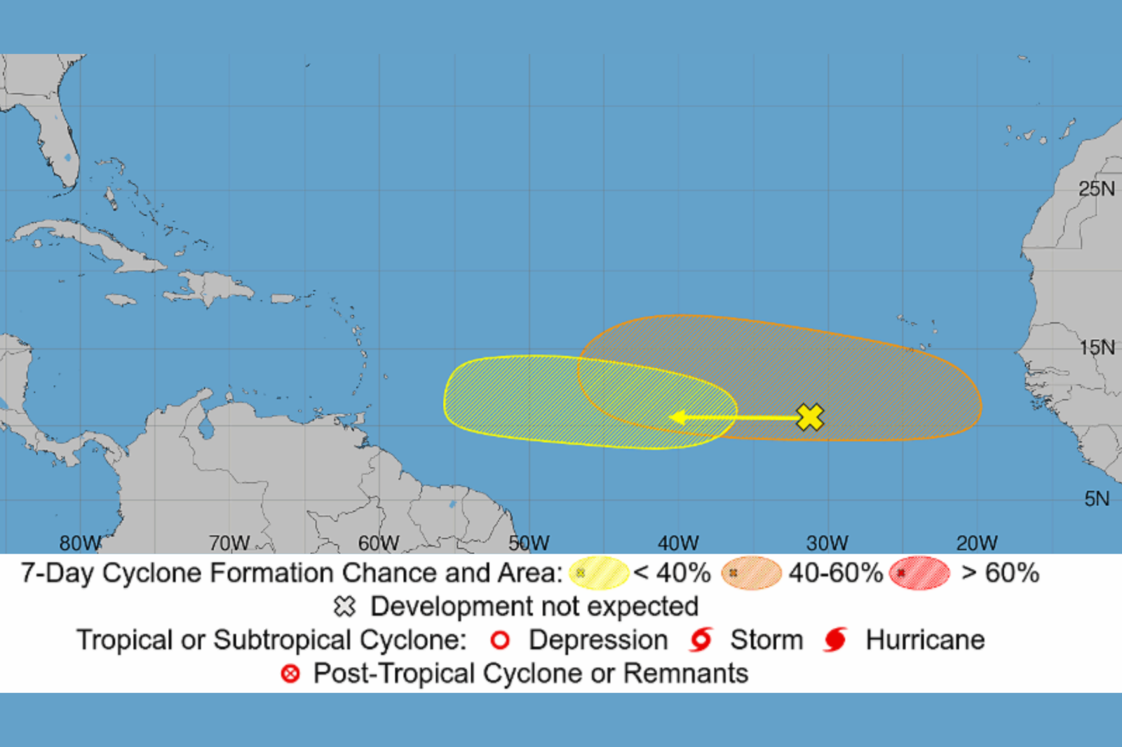
The NHC’s Atlantic Tropical Weather Outlook reports a broad area of showers and thunderstorms. This area is associated with a tropical wave located several hundred miles southwest of the Cape Verde Islands, off Africa’s west coast. It is moving westward across the central tropical Atlantic. While there might be some development early to midweek, forecasters caution that upper-level winds may become unfavorable later in the week near the Lesser Antilles. This system has near-zero development potential within 48 hours and a 20 percent chance over seven days.
Another tropical wave is expected to move off Africa’s west coast soon. Environmental conditions appear more supportive of development, with the NHC indicating a possible tropical depression formation later in the week. This disturbance has a 40 percent development chance over the next seven days.
Three Additional Pacific Threats
In the Eastern Pacific, three areas are being monitored. Notably, a tropical wave over 1,000 miles east-southeast of Hawaii shows a large area of disorganized showers and thunderstorms. The NHC anticipates a tropical depression forming within days as the system moves west-northwest across the Central Pacific, with a 90 percent chance of development this week.
The second disturbance is southwest of the Baja California Peninsula, holding a 50 percent development chance in seven days. Meanwhile, a third low-pressure area off Mexico’s southwestern coast has a 10 percent chance.
Potential Impact on Land
The Atlantic and Pacific systems currently remain over open waters. Predictions regarding land impact and intensity are uncertain as none have developed a clear circulation. Their future tracks are monitored closely.
Significance of Current Activity
The rise in tropical disturbances indicates increased activity in the Atlantic hurricane season. Historically, August marks an uptick in tropical activity, with early September traditionally being the peak. Although current systems don’t threaten the United States, tropical waves from Africa are monitored closely due to their potential development into storms and hurricanes, as noted by The Weather Channel. At present, attention is on the tropical wave from Africa and the Central Pacific disturbance near Hawaii as the likely next tropical depressions.
For this story, contact Newsweek editors: Matthew Robinson and Robert Greenall.