
The Atlantic hurricane season typically aligns with a timeline starting on June 1 and concludes on November 30 annually. The current year indicates a decrease in the usual number of storms, as predicted by the National Oceanic and Atmospheric Administration (NOAA). Keep track of each storm this hurricane season for latest updates.
No active storms are present at the current time.
Previous Storms Overview
Tropical Storm Arthur
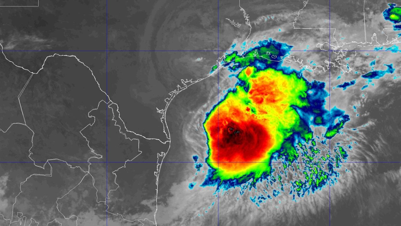
On June 16, at 10 a.m., the National Hurricane Center identified Potential Tropical Cyclone One located approximately 65 miles southwest of Corpus Christi, Texas. It had sustained winds reaching 30 mph, moving northeast at 6 mph.
- June 16, 4 p.m.: A Tropical Storm Warning was issued for the Louisiana coast stretching from Sabine Pass to Morgan City.
- By June 17, 10 a.m., Tropical Storm Arthur formed about 40 miles east-northeast of Port O’Connor, Texas, with winds of 40 mph, moving northeast at 9 mph.
- Later that day at 10 p.m., Arthur transitioned to a post-tropical cyclone about 35 miles north-northeast of Galveston, Texas, with sustained winds of 35 mph.
Tropical Storm Bertha
Started as Tropical Depression Two on July 19, 10 a.m., situated 155 miles south of Panama City, Florida. It had winds of 30 mph and motion toward north-northwest at 2 mph.
- On July 20, 7 p.m., it strengthened to Tropical Storm Bertha roughly 110 miles south of Panama City, Florida, with 40 mph winds.
- July 21 saw it escalate to maximum strength with 60 mph winds, followed by its landfall near Biloxi Wildlife Management Area in St. Bernard Parish, Louisiana, on July 22 with 45 mph winds.
- Bertha weakened to a tropical depression on July 23, dissipating near Houston, Texas.
Tropical Storm Cristobal
On August 12, 10 a.m., Tropical Storm Cristobal emerged approximately 880 miles west of the Azores with sustained winds of 45 mph, moving east at 25 mph.
- By August 13, it weakened to a tropical depression and ultimately transitioned to a post-tropical remnant low.
Tropical Storm Dolly
Developed on August 27, 10 a.m., situated around 1,555 miles east of the Leeward Islands with winds of 40 mph, moving west at 24 mph.
- It dissipated on August 28 about 1,000 miles east of the Leeward Islands.
Tropical Storm Edouard
Started as Potential Tropical Cyclone Five on August 31, 10 a.m., located 130 miles south of Morgan City, Louisiana with 35 mph winds.
- By September 1, Edouard reached its strongest at 60 mph before landfall near Johnson Bayou, Louisiana.
- Later on September 3, it dissipated near Dallas, Texas.
Tropical Depression Fay
Formed on September 19, 10 a.m., 525 miles southwest of the Azores as TD Six, moving north at 2 mph.
- Fay reached its peak with 70 mph winds, weakened, and eventually dissipated on September 23.
- Fay briefly redeveloped and then diminished again by September 29.
Tropical Storm Gonzalo
Formed on September 24, 10 p.m., located about 190 miles southeast of the southernmost Cabo Verde islands with winds of 45 mph.
- Reached its maximum on September 25 and dissipated the day after.
Tropical Storm Hanna
Developed on September 28, 10 a.m., positioned 870 miles east-northeast of Bermuda with winds of 45 mph.
- It dissipated two days later far east of Bermuda.
Hurricane Isaias
Began as Tropical Depression Nine on October 6, 4 p.m., 380 miles west of Progreso, Mexico with 35 mph winds, becoming a Category 3 hurricane by October 9.
- Landfall occurred near Destin, Florida on October 9 as a Category 2 hurricane.
- Isaias weakened to a tropical storm on October 10 and became post-tropical in Alabama.
Sources: NOAA, National Hurricane Center