
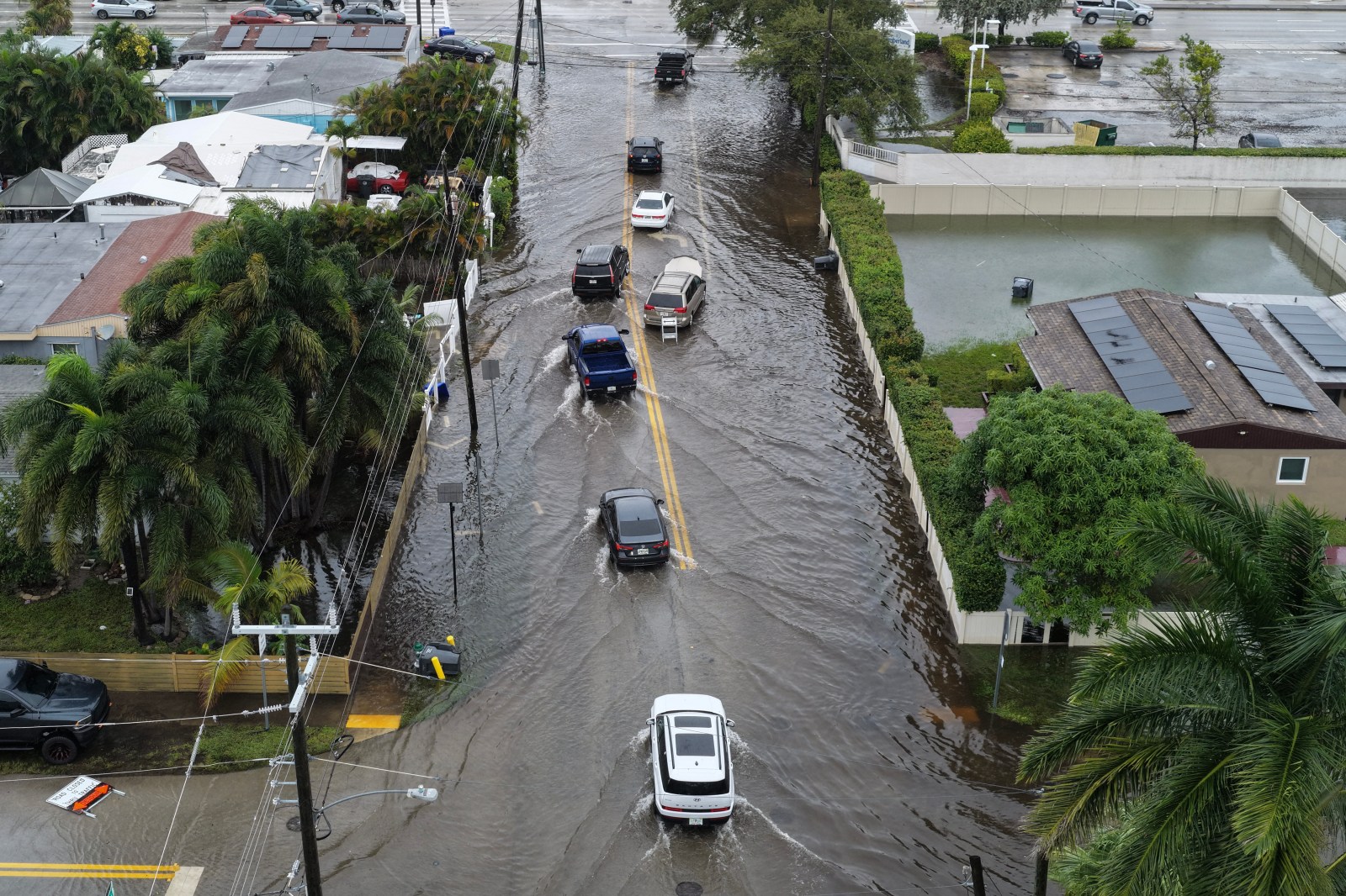
At least nine states in the U.S. have already faced extreme weather conditions attributed to the strengthening super El Niño in the Pacific Ocean. Meteorologists caution that these conditions might intensify as winter draws near. Recently, Florida experienced heavy rainfall, while the Pacific Northwest endured several atmospheric river events, with a new storm expected soon.
The National Weather Service’s Climate Prediction Center has updated its insights on the El Niño climate pattern. Forecasters say the pattern is likely to become strong-to-very-strong and persist through March next year. AccuWeather’s lead U.S. long-range forecaster, Paul Pastelok, indicated that El Niño’s effects could last beyond its peak.
Understanding Super El Niño
El Niño, a climate phenomenon in the tropical Pacific Ocean, features unusually warm waters that can influence global weather. Many meteorologists refer to the current event as a super El Niño. The National Oceanic and Atmospheric Administration (NOAA) describes it as “very strong.” This event is marked by water temperatures exceeding 2 degrees Celsius above average. The current El Niño has surpassed this, reaching 4 degrees Celsius above average and still rising.
El Niño’s effects are already evident across the U.S. Recently, southeast Florida faced severe rainfall. According to meteorologist Ben Noll from The Washington Post, Broward County experienced over 20% of its average annual rainfall in a single day. He predicts ongoing extreme rainfall threats due to El Niño and the record warm Gulf and Atlantic waters.
Apart from Florida, eight other states have encountered El Niño-related impacts. The Pacific Northwest states like western Oregon, Washington, and northern California have been affected by atmospheric rivers, leading to heavy rain, wind, and coastal flooding. Mountain regions faced significant weather challenges.
In southern California and the U.S. Southwest, El Niño influenced weather patterns significantly over the summer, triggering an active Eastern Pacific hurricane season. Areas like Arizona and southern Nevada experienced tropical moisture impacts.
Meteorologist Scott Lawrimore from The Weather Channel stated that Americans can expect a recurring weather pattern this winter, affecting the West Coast, Gulf Coast, and Florida.
In the Northeast, El Niño brought an early-season nor’easter in late September, causing flooding, power outages, and widespread disruptions. Virginia, North Carolina, and Massachusetts have been particularly affected.
However, some states, including Mississippi, Louisiana, Arkansas, and Tennessee, have not yet experienced major impacts. Pastelok noted that while there have been storms potentially linked to El Niño, none have stood out.
El Niño’s Impact on U.S. Weather
El Niño’s warmer waters amplify its influence on U.S. weather, especially during fall and winter. The South tends to experience cooler, wetter conditions, while the North sees warmer, drier weather. El Niño also affects storm tracks, whether precipitation falls as snow or rain, and leads to extreme cold spells.
Meteorologists Lawrimore and Pastelok confirm that the weather impacts are progressing as anticipated. The West Coast, Gulf Coast, and Southeast should continue to see impacts through winter. Central U.S. regions, including areas like Omaha, Nebraska, and Kansas, might also face significant storms. People should monitor forecasts and prepare as weather patterns develop.